We’ve been waiting to hike up Fremington Edge in Swaledale for a long while now. This was the first weekend we have all been free to do so, so despite the threat of heavy fog we went for it.
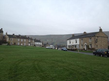
We met at Reeth and parked on the village green. Parking at Reeth is very cheap at only £1 for the full day! We were lucky and found a parking spot easily, but on a busy day (especially in the summer) it does get very busy. If you arrive and are stuck for parking people often park along Gunnerside Road. There is also a public toilet in the village opposite the Black Bull pub and a newsagent if you need any snacks for your walk.
The Fremington Edge hike is a circular walk starting at Reeth and arriving back in Reeth. From the car park walk across the green and head to the top right of the village towards the Ivy Cottage Tearoom.
Head down the road to the left of the tearoom which takes you down to the Arkle Beck. Arkle Beck flows from high moorland near to Tan Hill Inn. It is a fast flowing tributary to the River Swale which it meets by the Grinton Bridge. When you arrive at the beck turn right following the flow of the beck until you reach the bridge and take the path up onto the bridge road.
Once on the bridge you shall see the Reeth garage, and to the right of the garage there is a stile, climb over the stile and walk along the footpath to the right across four fields to the pretty hamlet of High Fremington.
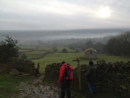
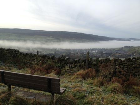
Once in High Fremington head up the narrow lane past the cottages. When the road forks, bear left between two cottages and continue up this road. This section of the walk is quite steep but there are a couple of benches with a great view across Reeth and the Swaledale Valley straight ahead and Arkengarthdale to the right. Unfortunately our view was obstructed by the unusual fog that had settled in the valley.
The road will eventually fork again when you reach the aptly named ‘White House’ bear right up a rough track which takes you to the top of Fremington Edge.
When you reach the top our guide book said to go through the gate, and walk left along the wall for about a mile. Due to the level of rain we have had the moorland on that side of the wall was very boggy, so we opted to stay on the right of the wall where the ground was far less water logged…and coincidentally had a better view. There is a lot of evidence of the mining industry that the area is famous for on the surrounding moors on the right.
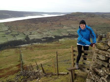
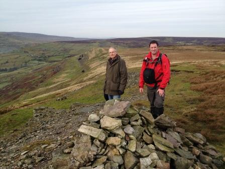
Once over the stile continue for around a mile and you will reach the cairn. We decided this was the perfect spot to have lunch as was the half-way point, and had spectacular views across Arkengarthdale and the tiny hamlet of Booze.
After walking over a mile we reached a stile to the far left of the wall. The stile was on a very steep section of Fremington Edge, so, if like me you’re scared of heights make sure you hold on tight as you climb it.
We continued on towards the remote village of Booze. The path met with the popular mountain bike bridleway that starts at the village of Hurst to the right. We followed this bridleway which zigzags down Fremington Edge. Eventually the path brought us out by a house at the bottom of the hill. Walk through this gate and bear left.
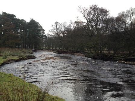
Take the path in-between two Yorkshire Stone Walls, this will lead you to a field. Walk through this and the next field and you shall reach the Arkle Beck. From here there are two options you can either walk along the beck or take a higher path. As the beck was not that high we chose to walk along the beck as this route has beautiful woodlands and during the summer stunning meadows.
Worth mentioning that if you choose this route it can be very muddy after heavy rain. It was accessible for us but there were certain times we struggled as the mud was very deep. It’s also worth noting that although the beck looks very calm it has been known to be a very destructive force. It has risen 12ft above its normal level, destroying Whaw’s Bridge and flooding Langthwaite.
Take the path in-between two Yorkshire Stone Walls, this will lead you to a field. Walk through this and the next field and you shall reach the Arkle Beck. From here there are two options you can either walk along the beck or take a higher path. As the beck was not that high we chose to walk along the beck as this route has beautiful woodlands and during the summer stunning meadows.
The path takes you up past a remote house and then through a number of fields. You’ll reach a fork in the path, take the path to the right through the field and climb across the broken wall and into the next field.
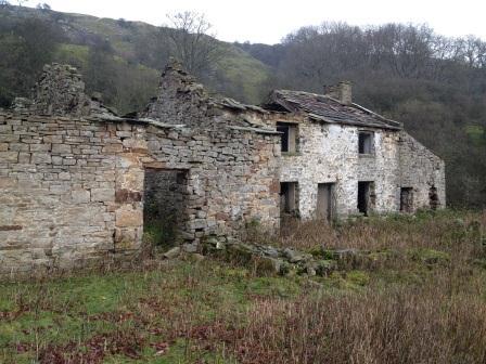
The path will take you past some interesting ruins and then brings you back down to the Beck edge very briefly and then back up slightly higher with a Yorkshire stone wall on your right.
Walk through the farmer’s gate and through this field which takes you back down to the bridge by the Reeth garage. Follow the road up this hill passed to the newsagents until you reach the car park.